Shoreline field diagram
The four intertidal zones
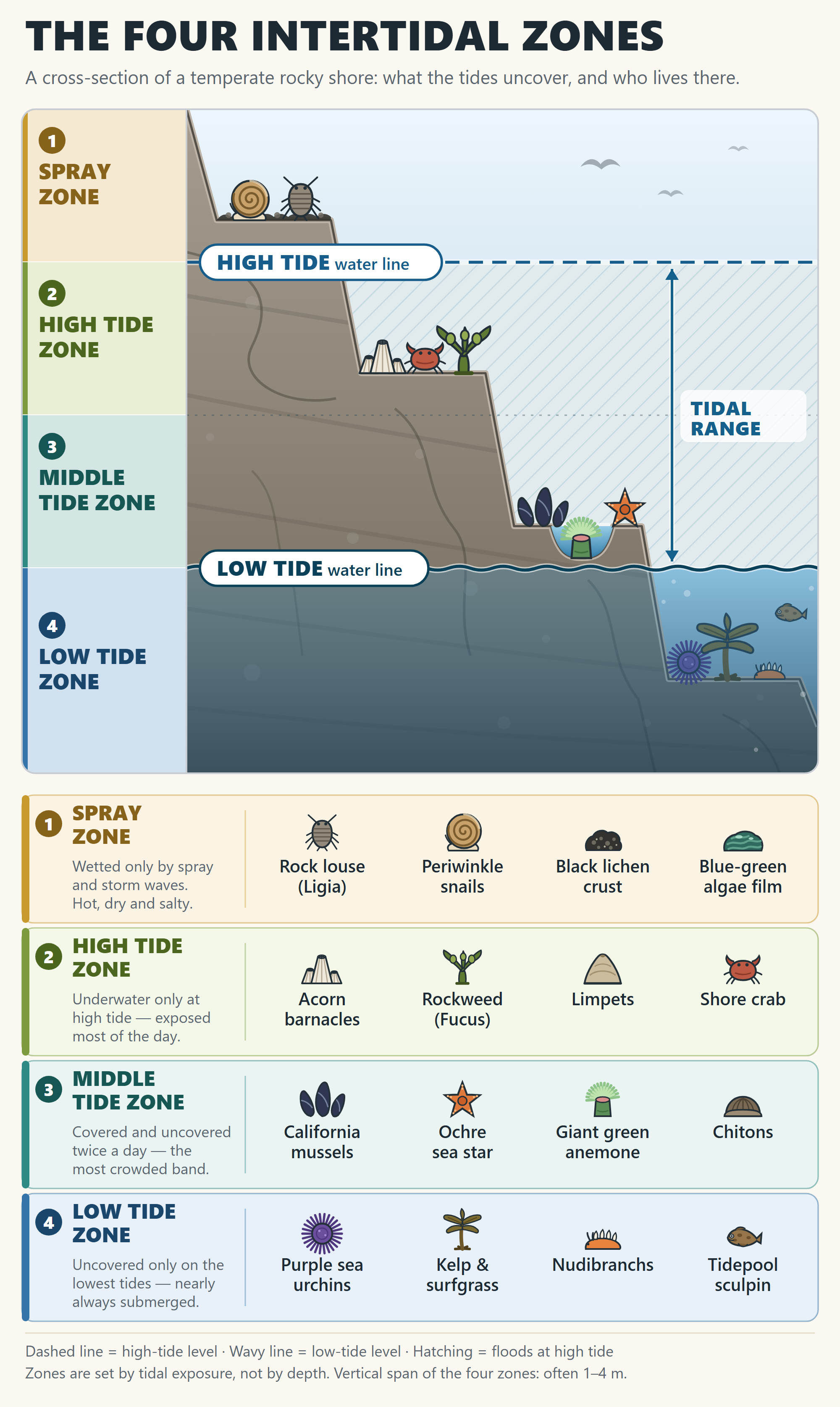
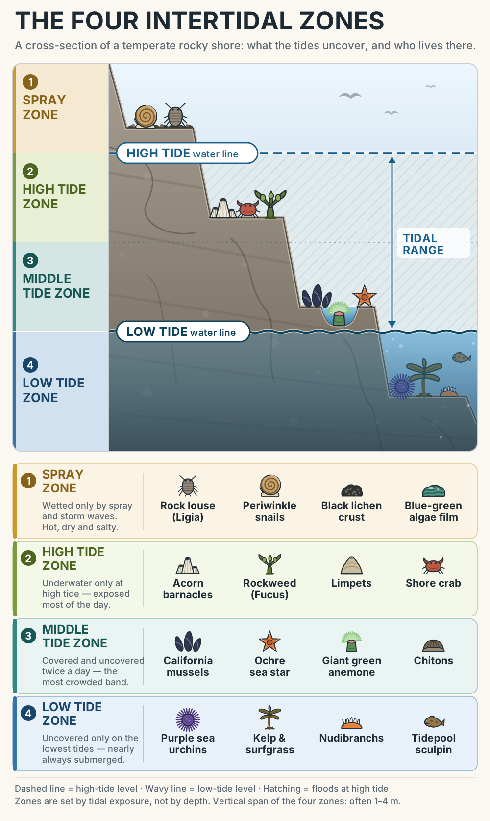
A labelled cross-section of a temperate rocky shore — both tide lines, the four zones they carve out, and the animals and seaweeds that live in each band.
How to read it
- Dashed line = the high-tide water level; wavy line = the low-tide water level. The hatched space between them floods and drains twice a day.
- The zones are set by how long the tide leaves them exposed, not by depth — so they run as horizontal bands across the rock, whatever its shape.
- The rock below the low-tide line keeps its blue veil because it is essentially never uncovered; zone 4 only appears on the lowest tides of the month.
- Species are typical of temperate rocky shores (the north-east Pacific set is shown). Your local shore will have the same four bands with its own cast.